


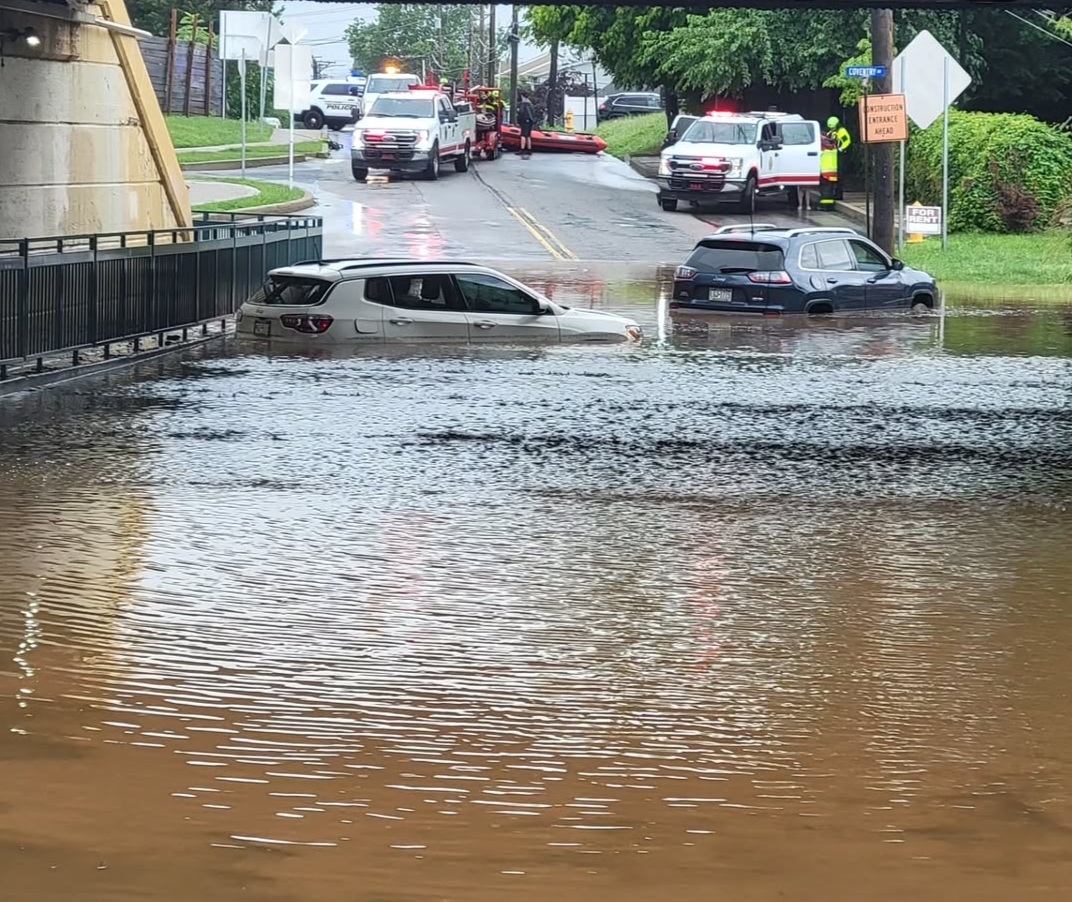
Credit: Bristol Township Fire Rescue
Heavy rainfall triggered flash flooding across parts of Bristol Township on Monday.
Advertisements
The late-morning and early-afternoon downpours caused the Cedar Avenue underpass near the Croydon Train Station to fill with water.
Bristol Township Fire Rescue and the Croydon Fire Company deployed boats to the scene after several cars became stranded in the rising floodwaters.
Police closed Cedar Avenue for more than an hour in the area of the underpass due to the flooding.
Advertisements
Flooding also reported across multiple Croydon streets, including Spencer Avenue, and water poured across Newportville Road and flowed toward the Neshaminy Creek.
The National Weather Service reported that Bristol received 3.5 inches of rain on Monday.
Advertisements
The region was under a flash flood warning through Monday afternoon.
Road flooding was reported along State Road and Station Avenue in Bensalem Township due to the storms.
According to the National Weather Service, at least two vehicles were reported to have become stuck in floodwaters in Bensalem Township.
Advertisements
By late Monday night, the high waters had receded and all local roads were reopened.
Monday’s severe weather came after several days of evening storms that brought rain, damaging winds, and scattered power outages across the county.
Advertisements
Over the past several days, 64 of Pennsylvania’s 67 counties reported severe storms, state officials said.
Pennsylvania Emergency Management Agency Director Randy Padfield told reporters that risks for additional rain and possible flash flooding remain throughout the week.
Advertisements
Padfield advised Pennsylvanians to use caution and to never drive through moving waters or flooded areas.
Below is the upcoming forecast from the National Weather Service:
Tuesday: A chance of showers, mainly before 8am. Cloudy, with a high near 76. Northeast wind around 5 mph. Chance of precipitation is 40%. New precipitation amounts of less than a tenth of an inch possible.
Tuesday Night: A slight chance of showers and thunderstorms before 8pm, then a slight chance of showers between 8pm and 11pm. Mostly cloudy, with a low around 65. Northeast wind around 5 mph becoming calm in the evening. Chance of precipitation is 20%.
Advertisements
Wednesday: Mostly sunny, with a high near 83. Northeast wind around 5 mph becoming calm in the morning.
Wednesday Night: Partly cloudy, with a low around 66. Calm wind.
Thursday: A slight chance of showers, then showers likely and possibly a thunderstorm after 2pm. Partly sunny, with a high near 85. Calm wind becoming southwest around 5 mph in the afternoon. Chance of precipitation is 60%. New rainfall amounts of less than a tenth of an inch, except higher amounts possible in thunderstorms.
Thursday Night: Showers likely and possibly a thunderstorm before 2am. Mostly cloudy, with a low around 71. Chance of precipitation is 60%. New rainfall amounts of less than a tenth of an inch, except higher amounts possible in thunderstorms.
Friday: A chance of showers and thunderstorms after 2pm. Mostly sunny, with a high near 90. Chance of precipitation is 40%.
Friday Night: A chance of showers and thunderstorms before 8pm, then a chance of showers between 8pm and 2am. Mostly cloudy, with a low around 70. Chance of precipitation is 40%.
Advertisements
Saturday: Partly sunny, with a high near 86.
Saturday Night: Partly cloudy, with a low around 67.
Sunday: A chance of showers. Mostly sunny, with a high near 86. Chance of precipitation is 30%.
Sunday Night: A chance of showers. Partly cloudy, with a low around 67. Chance of precipitation is 30%.

