


Ahead of the 250th anniversary of the country on July 4th, residents are looking to balance the fun festivities of the weekend with staying cool and safe.
More than 100 million people in the United States are under heat warnings of some kind. That impact has been felt in Bucks County as well.
Advertisements
The National Weather Service issued an Extreme Heat Warning that will last until 8 p.m. on Saturday
When the weather is this hot, there are multiple risks posed to people especially for potential heat related illnesses.
Dr. Gerald Wydro, the chief medical officer for St. Mary Medical Center in Middletown Township and Nazareth Hospital in Philadelphia, mentions that when the temperature goes up you see a big increase in heat related illnesses. This is especially true for people with underlying medical issues.

Credit: Submitted
Advertisements
“People with underlying illnesses like asthma, congestive heart failure, emphysema. Those symptoms get more difficult,” said Wydro about the types of underlying illnesses that are the most affected by times like these.
Wydro also mentioned when the heat goes up you have a higher risk of developing heat-related illness like heat exhaustion and heat stroke which are both serious.
Advertisements
Something that is important during hot weeks like this is staying cool and taking whatever steps possible to stay safe and inside.
The Pennsylvania Department of Health has posted a list of symptoms that are typically found in people with heat stroke. Those include an abnormally high body temperature (above 103 degrees), dizziness, and nausea, etc. They also mention what to do if someone is experiencing one. That includes calling medical attention and to move the person to a shaded area.
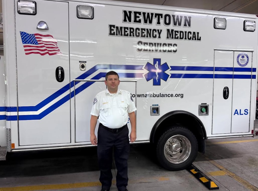
Evan Resinkoff, chief of Newtown Emergency Medical Services, who has been in that role for 11 years, spoke about how reducing outdoor activities is also important when it comes to preventing any potential problems.
Credit: Stephen Zaglin/LevittownNow.com
Advertisements
“If you have to do yard work, do it very early in the morning or later in the evening, at dusk,’ he said.
Resinkoff also gave some specific tips when it comes to what to drink.
“Avoid alcohol, drink plenty of fluids.”
This would include Gatorade mixed with water since straight Gatorade has a lot of sugar. He also said to stay away from carbonated beverages with high sugar.
Advertisements
It is also important for people like Resinkoff to stay cool because they often have to go on calls and help people who are feeling hot while also usually wearing certain uniforms that may increase the heat they feel.
Resinkoff and Lt. Andrew Foley, of the Penndel-Middletown Emergency Squad, said that ambulance squads place different rules in place to help keep them and their teams safe.
Advertisements
Foley mentioned how during heat waves like this they “lighten up their dress code.”

Credit: Tom Sofield/LevittownNow.com
At the Penndel-Middletown Emergency Squad, the hot weather dress includes wearing polo shirts while on duty, as well as baseball hats to keep the sun out of their eyes.
Advertisements
Bucks County recently announced cooling centers in the area that people can go to cool off from the heat.
The heatwave should start to die down by the end of the weekend.
The forecast from the National Weather Service:
Friday: Sunny and hot, with a high near 103. Heat index values as high as 111. West wind 5 to 10 mph.
Friday Night: Isolated showers and thunderstorms before midnight. Mostly clear, with a low around 79. West wind around 5 mph. Chance of precipitation is 20%.
Independence Day: Isolated showers and thunderstorms after 2pm. Sunny and hot, with a high near 99. Heat index values as high as 104. West wind 5 to 10 mph. Chance of precipitation is 20%.
Saturday Night: Scattered showers and thunderstorms. Mostly cloudy, with a low around 74. West wind around 5 mph becoming calm in the evening. Chance of precipitation is 50%. New rainfall amounts of less than a tenth of an inch, except higher amounts possible in thunderstorms.
Advertisements
Sunday: A chance of showers before 11am, then a slight chance of showers and thunderstorms between 11am and 2pm, then showers likely and possibly a thunderstorm after 2pm. Mostly cloudy, with a high near 90. Northeast wind around 5 mph. Chance of precipitation is 70%. New rainfall amounts between a tenth and quarter of an inch, except higher amounts possible in thunderstorms.
Sunday Night: Showers and possibly a thunderstorm. Low around 69. Chance of precipitation is 80%. New rainfall amounts between three quarters and one inch possible.
Monday: Showers likely, with thunderstorms also possible after 2pm. Mostly cloudy, with a high near 83. Chance of precipitation is 70%.
Monday Night: Showers likely and possibly a thunderstorm. Mostly cloudy, with a low around 67. Chance of precipitation is 70%.
Advertisements
Tuesday: A chance of showers, with thunderstorms also possible after 2pm. Partly sunny, with a high near 83. Chance of precipitation is 40%.
Tuesday Night: A chance of showers and thunderstorms before 8pm, then a chance of showers between 8pm and 2am. Mostly cloudy, with a low around 67. Chance of precipitation is 30%.
Wednesday: Partly sunny, with a high near 86.
Wednesday Night: Partly cloudy, with a low around 68.