Credit: Tom Sofield/LevittownNow.com
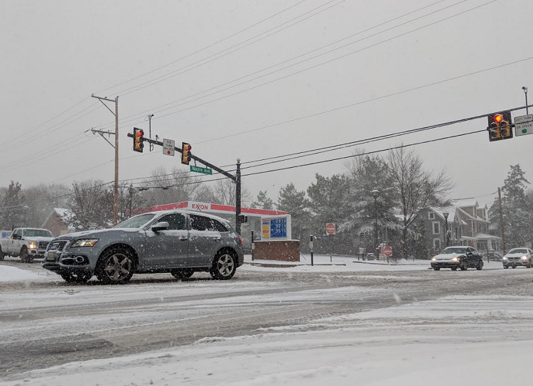
The National Weather Service has updated its snowfall predictions for Lower Bucks County, with forecasters now expecting between 4 to 8 inches of snow as a winter storm approaches the region on Sunday.
Advertisements
Ahead of the storm, several local municipalities have declared snow emergencies.
The increased snow total forecast comes as the National Weather Service’s regional forecast office predicts snowfall rates could exceed 1 inch per hour at times.
The storm is expected to begin late Sunday morning and persist through Sunday night. It may feature periods where rain may mix with snow.
Advertisements
A Winter Storm Warning has been issued for all of Bucks County.
Good morning! The forecast has trended colder and snowier so we've expanded the Winter Storm Warning and it now includes all of SE PA, including Philadelphia, extending into portions of central NJ.
— NWS Mount Holly (@NWS_MountHolly) January 19, 2025
See our latest briefing at: https://t.co/JiD09ByGTv #PAWX #NJWX #MDWX #DEWX pic.twitter.com/ImopjtGOQ1
Along with the snowfall, residents should also prepare for a significant drop in temperatures.
Advertisements
Forecasters describe the incoming temperatures as “dangerously cold” weather.
Temperatures are expected to plummet well below freezing Sunday night and will not rise above freezing until late in the week.
The coldest conditions are forecasted from Monday night through Thursday morning, with daytime highs only in the teens and overnight lows dipping into the single digits or even below zero.
Advertisements
The forecast includes nighttime wind chills falling below zero degrees, with only slight recoveries into the single digits during the day.
The forecasted extreme cold poses an increased risk of hypothermia and frostbite, prompting warnings from local health officials. Additionally, the frigid temperatures could lead to frozen pipes and a surge in energy demand for heating.
Advertisements
Bristol Borough officials advised residents that there will be no parking on Mill Street and the 100 block of Radcliffe Street from noon Sunday until midnight.
In Bristol Township, officials declared a snow emergency from noon Sunday to noon Monday.
Advertisements
“Please remove all cars from the public roads to assisting our snow removal efforts. Please call the BTPD non emergency line at 215-785-4040 with any concerns of vehicles not removed and hindering plowing efforts,” a statement said.
Falls Township declared a snow emergency ahead of the storm. It will start Sunday at 2 p.m. and continue through Monday at 3 p.m.
Advertisements
“All vehicles, boats, trailers, etc. must be moved off all township streets on to your property so emergency vehicles and plows can safely navigate down your street,” Falls Township Fire Marshal Rich Dippolito said.
Starting at noon on Sunday, Middletown Township will be in a snow emergency.
“Township crews will be working hard to clear any accumulated snow on residential streets. Please move cars off roadways so we may completely plow roads. More information about how we respond to a snow storm can be found on our website,” the township said in a statement.
Credit: Tom Sofield/LevittownNow.com
Advertisements
Langhorne Borough police said the borough declared a snow emergency from 10 a.m. Sunday to 10 a.m. Monday. They asked people to keep vehicles off the borough streets during the snowfall.
“Our area is forecasted to get more snow today, starting around noon. Residents are reminded to remove their vehicles from the roadway so our plows can safely and efficiently clear the snow,” Hulmeville Borough police said.
Advertisements
Tullytown Borough declared a snow emergency through midnight on Sunday. Officials said all vehicles must be off the borough’s streets.
Below is the forecast from the National Weather Service:
Sunday: Snow likely before 2pm, then snow, possibly mixed with rain between 2pm and 4pm, then snow after 4pm. The snow could be heavy at times. High near 35. North wind 5 to 10 mph. Chance of precipitation is 90%. Total daytime snow accumulation of 2 to 4 inches possible.
Sunday Night: Snow, mainly before 10pm. The snow could be heavy at times. Areas of blowing snow. Low around 17. Northwest wind around 15 mph. Chance of precipitation is 80%. New snow accumulation of 1 to 3 inches possible.
M.L.K Day: Mostly sunny, with a high near 23. West wind 10 to 15 mph, with gusts as high as 25 mph.
Monday Night: Mostly clear, with a low around 5. Wind chill values as low as -6. West wind around 10 mph.
Advertisements
Tuesday: Partly sunny, with a high near 17. West wind 5 to 10 mph.
Tuesday Night: A chance of snow. Mostly cloudy, with a low around 6. Chance of precipitation is 30%.
Wednesday: Sunny, with a high near 17.
Wednesday Night: Partly cloudy, with a low around 2.
Thursday: Mostly sunny, with a high near 24.
Thursday Night: Mostly cloudy, with a low around 9.
Advertisements
Friday: Mostly sunny, with a high near 31.
Friday Night: Partly cloudy, with a low around 16.
Advertisement

Convenient Legal Access to High Quality Cannabis Just A Few Minutes Away!

Canna Remedies: Educate Curate Elevate
Report a correction via email | Editorial standards and policies